


The Physical Geography of Wareham
An Excerpt from My Doctoral Dissertation in History

( Dear Readers: there is a meeting of the Wareham Planning Board that may interest you, on three potentially concerning solar projects [read: deforestation and strip mines], two by A.D. Makepeace-New Leaf-Borrego, and one by Wareham PV1 LLC; the meeting will be held on Monday, December 12, 2022, at 6:00 P.M., at the Multi-Service Center, Room 320, located at 48 Marion Road, Wareham.
The Zoom link is here: https://us02web.zoom.us/j/85353505339?pwd=QWsycVJxVGJ4MERCQkNuWFM0bWFtQT09
In honor of that Town, I’m publishing a piece for paid subscribers, adapted from my doctoral dissertation, The Enduring Commons, on the physical geography of Wareham. )
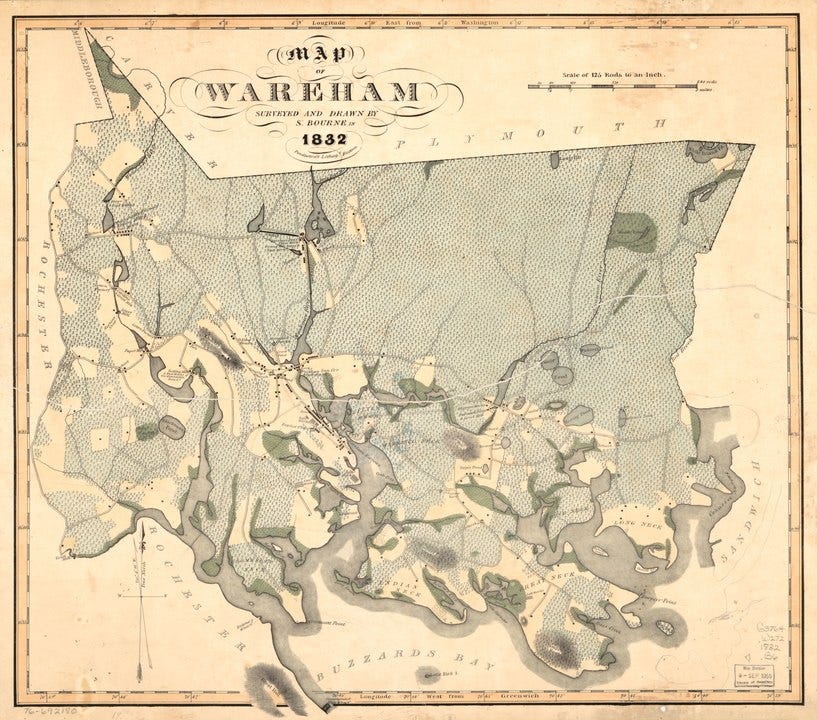
( 1832 Map of Wareham by S. Bourne, in Pendleton’s Lithography (Boston, 1832); photo credit — Library of Congress, Geography and Map Division. )
In geological terms, most of Wareham is, like its neighbor to the northwest, Carver, part of an extensive glacial outwash plain. Here, as the glaciers receded towards the Pole ten thousand years before the present, flowed great sheets of water to the sea, sweeping all manner of debris with them. The country, though generally level, has an uneven, rolling, and even sudden quality; it is also studded with kettle ponds and swamps, many of which have been turned into cranberry bogs. In its far eastern and northeastern section, the Town also contains a portion of the great recessional moraine that forms the spine of the Plymouth Pine Hills. A north-northwest line of recession can be drawn from the terminal moraine at Falmouth on Cape Cod to the Pine Hills, and then further north to Monk's Hill in Kingston. This rises to its greatest height, locally, in the lofty hills of Bournedale (itself a village of Bourne, and not part of Wareham) that rise in the interior of Buttermilk Bay's northeastern shore.
The general orientation of Wareham is that of a line running from northeast to southwest along the northwestern shore of Buzzard's Bay; this coast, one of the most intensely indented in Massachusetts, is home to numerous coves and necks (the local name for a peninsula), islands and estuaries that render its coastline particularly productive ecologically. Spreading salt-marshes, productive shellfish beds, and historically plentiful inshore and estuarine fisheries render the coast of interest to humans and wildlife species alike.