


A Watery Land: Routes of Diplomacy and War in the 17th Century
An excerpt from my doctoral dissertation, "The Enduring Commons: Ecology, Politics, and Economic Life in Plymouth County, Massachusetts; 1691-1815"

In the Seventeenth Century, the waterways of Plymouth County were used not only for subsistence activities, but, quite significantly, as routes of travel, trade, diplomacy and war between the Algonquian peoples of Southeast New England and the European colonists of the same. Indeed, just as in the 18th century these waterways would constitute a crucial site of the consolidation of a local Commons regime, in the 1600s, these rivers and lakes, streams and swamps, formed the physical locus for the contest between Algonquian and European peoples for political control of southeastern New England.
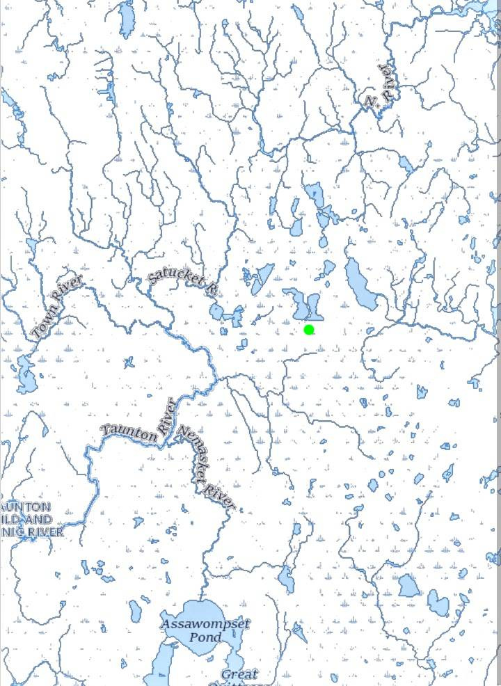
( The watery interior of Plymouth County. East and West Monponsett Pond are above the green dot. Historically, the current isthmus separating the two ponds was a series of islands. Photo credit — the United States Geological Survey and J. Benjamin Cronin.)
As mentioned above, the river systems of the North River and the Taunton River come quite close to one another in the center of the County. The crucial link between these two fluvial systems was, and is, Monponsett Pond, located mostly in today's Halifax, Massachusetts. At 528 acres, and with an average depth of 7 feet, the Pond would, in other parts of the country, be termed a “lake”; but in New England, a “pond” can be very large. The legal category of a Great Pond, a pond over ten acres that remains, to this day, open to common fishing, fowling and navigation, is a testament to this fact.